Methods
Summary
Areas identified by the satellite tags deployed between May 2015 and December 2016 will be ground truthed, to determine if these areas are associated with cleaning and feeding sites. The coordinated from each GPS point will be used to visit these identified areas that manta rays visit frequently. To explore the sites, I will snorkel and/or scuba dive to observe habitat type and species presence. I will look for cleaning stations, which are typically rocky or coral reefs with cleaner fish. If there is a high concentration of phytoplankton, this indicates a potential feeding site. I will also look at tide and current patterns, as this can affect the presence of manta rays. If manta rays are found, I will observe their behaviour to see if they are feeding or cleaning. If no manta rays are observed, multiple gopro cameras will be left on the reef to record for up to 8 hours, to see if any manta rays visit while we are not in the water.
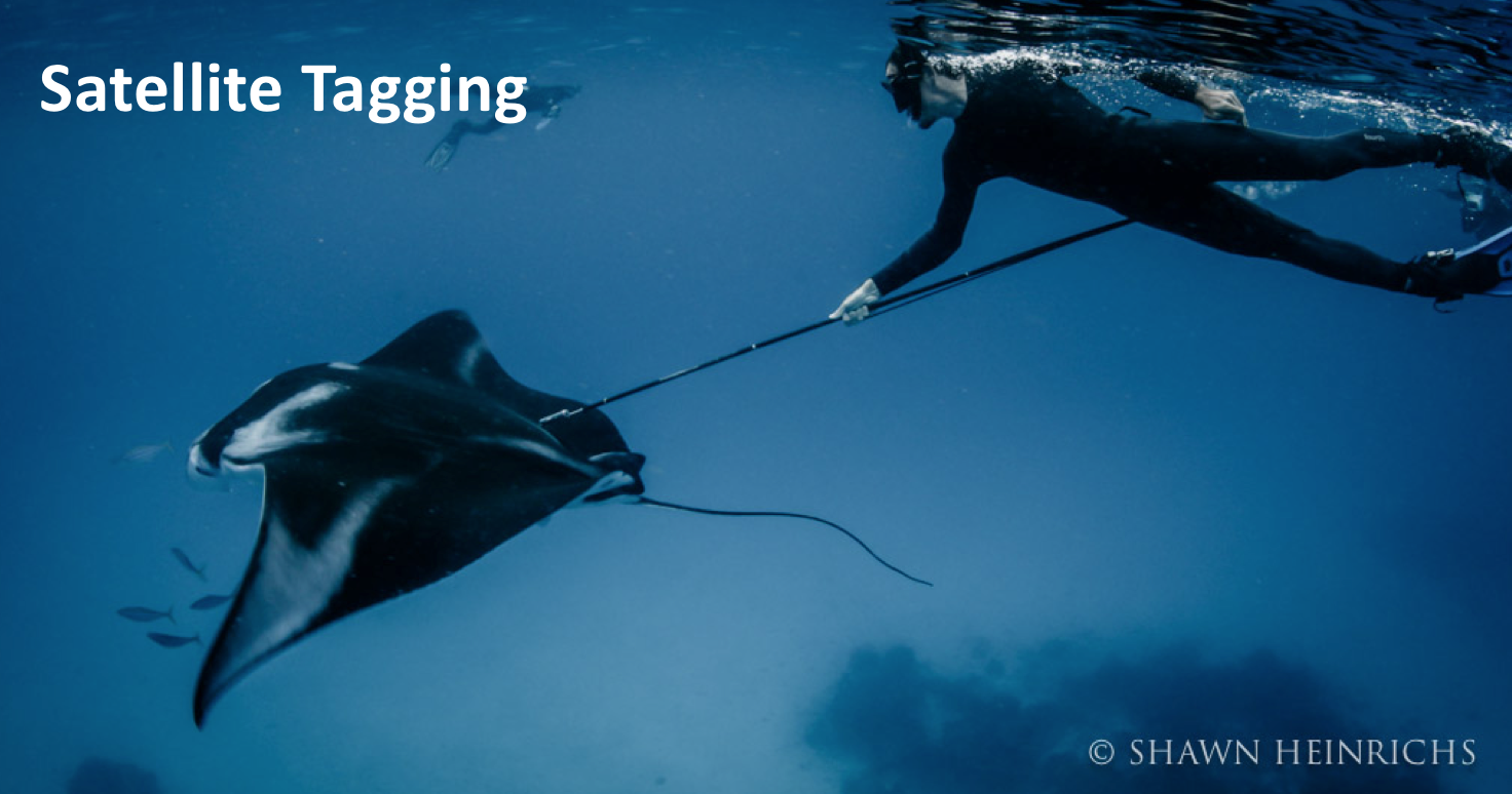 A titanium dart tip with a stainless-steel tether will be deployed with a pole spear to anchor the tag in the dorsum of animal. The anchor will be inserted at a 30-40 degree angle, with the tag trailing backwards, aiming in the crease between the body cavity and wings.
 Protocols
This project has not yet shared any protocols.