Haven't created any projects yet!
Haven't backed any projects yet!
Geospatial data analysis in final stages.
Using data from USFS LiDAR missions, as well as multispectral image data from DigitalGlobe, I have been able to identify several forest canopy charateristics that will be used to site ~70 biodivers...
Russian Wilderness Forest Communities: A Botanical Perspective - Research Review
August 6, 2016 UPDATE: The California DWF Biogeographical Data Branch forwarded me an updated library of Dr. Sawyer's early research this week. There comments were as follows: "What you unearthed w...
New Dynamic Map URL
http://unixlab.sfsu.edu/~pdunn...My field data will be uploaded to this map this week from the SFSU Geospatial Lab. Info boxes will be placed on each plot or point of interest and include pictures.
Fieldwork Photo Essay 1: Plot Siting
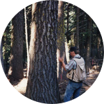
Despite a substantial heatwave that hit on the second day of the trip, I was able to accomplish what I set out to do on the initial visit to the Sugar Creek watershed in preparation...
Update on Project Funding
An outside source of funding allowed us to fully fund an HP EliteBook Workstation with a 1TB SSD ($1,500), and it will be needed given the volume and complexity of processing we anticipate. As well...
Forest Succession Classification - Connecting Patterns in Seral Communities to Plant Biodiversity
August 6, 2016 UPDATE: We have decided to use a classification scheme outlined in page 13 of "Creating a Forestry for the 21st Century: The Science Of Ecosytem Management", from a review of "succes...
LiDAR Point Cloud Analysis in a Nutshell
The software selected for forest canopy and classification analysis is the ENVI platform, which is coded in the Integrated Data Language (IDL), a scientific language used extensively by NASA and we...
Airborne laser sensing: forest structure and composition.
In early 2012, after an IT project wrapped up in New York, I traveled to the Olympic Peninsula by public transport with a backpack and went flyfishing for steelhead. I had done fair...
Siting Research
Many Northern California residents and visiting outdoor enthusiasts may not realize that within 600 kilometers of the SF Bay Area we have one of the most magnificent and studied temperate forest la...
