Memoirs from a Paleoecological Field Site: Mirror Lake Recap


Mirror Lake, (38’44’37 Lat/ 106’25’55 Long) is located within Taylor Park, in the Gunnison National Forest. It is just west of the Continental Divide. This was my first time into the park and subsequently over Cottonwood Pass. Although the drive is long, the view from the pass looking into the park is worth every minute.

Eastern facing view.

Western facing view.
There was not time to stay and admire the view this time, as evening had fallen and we were trying to get to our campsite beside Mirror Lake before dark. We arrived at our campsite just as night had fallen Friday night, tents went up, and we went to bed early.
The next morning (a balmy 7°C /45° F), breakfast began around 6:30 am. The rafts were inflated and assembled by 9:00 am. As the sun dipped down over the ridge and into the valley, I was able to see the lake for the first time.

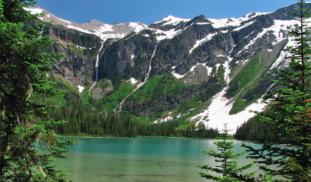
Mirror Lake is situated at 3,347 m (10,980 ft) in elevation. It is known as a kettle lake, formed from the processes of deglaciation and was carved in to the landscape thousands of years ago. This process left behind a lake nestled between two steep hill faces with slope aspects well within the desired range (28-52°) for this project.
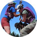
The morning went well and after several hours of preparation and assembling our raft, we were ready to set out into the lake. As you can see from the photo below, our platform was assembled and strapped to two PVC rafts. Across the platform crossbars were laid two wooden planks effectively making a floating work station. Tools and other equipment were slid below the platform to the bottom of the boats. The green dinghy was towed out behind us and useful for setting anchors in a quadrangle (to keep the boat from blowing about while working) and being able to quickly get back to shore if (or when) we realized we’d forgotten something.

The morning went smoothly, with good weather and calm winds. The first core was taken along the south bank, a slightly subtler slope, but with visible avalanche paths full of young aspen and smaller shrubs (early succession state vegetation). However, upon extraction at this location, the tell-tale signs of disturbance (visible layers within the sediments such as sand and macro fossils) were not there.
The afternoon was disrupted by thunder and rain showers. The rain, we could have handled, but being out in the middle of a lake with a tall metal rod is not an ideal situation for a lightening storm. By way of dinghy, myself and field assistant Shelley were deposited along the western shore with the core (still ensconced within the Kline Short-coring device with piston attached). Dr. Briles and field assistant Alex tied the raft off with anchors and hastily rowed the dinghy back to shower as the rain raced across the lake. Several attempts to get back to the rafts were discouraged by thunder and storm clouds.
The next day remained cloudy, with colder temperatures but the rain held off. We were able to get back out to the rafts and relocate to the central east bank, at the base of a rather large slide, where rock and other materials were sent down the slope, across the small road and into the lake. Upon extraction of the second two cores at this location, visible signs of disturbance could be seen in the cores.

In all, three successful cores were taken extracted from Mirror Lake to be brought back to the University of Colorado Denver. These cores, along with those taken by the Briles lab from 2013 will create an excellent snap shot of past disturbance events for the area.
More photos of from Mirror Lake weekend:


Note: Photo source for aerial view of Mirror lake from Google Earth.
More to come from my second field site, stay tuned!
1 comment