About This Project
The Pinaleño Mountains in Arizona have an unusually flat summit. Why haven't streams carved it into rugged peaks? I hypothesize that streams lack the coarse sediment needed to erode farther uphill. I will test this by comparing new summit erosion rates with published rates from the steep sides, alongside my previous field and landscape analyses. Together, these findings could help scientists recognize how sediment shapes mountain landscapes, bridging theory and real-world observations.
Ask the Scientists
Join The DiscussionWhat is the context of this research?
The Pinaleño Mountains rise over 10,000 ft in southeastern Arizona's Basin and Range, with steep sides surrounding an unusually flat summit. Despite millions of years without mountain building (uplift), streams have not carved it into rugged peaks.
My fundamental question is: What surface process is keeping the summit of this mountain range so flat? Uplift, climate, and rock type alone cannot fully explain its shape. The answer may lie in the sediment carried by streams.
Coarse sediment acts like sandpaper, helping mountain streams grind into bedrock. Without enough coarse sediment, erosion is inhibited. I hypothesize that the summit supplies water but little coarse sediment, making it harder for streams below to carve farther uphill. To test this, I will collect sediment samples to measure long-term summit erosion rates and compare them with published rates from the steep sides. Much slower summit erosion would support my hypothesis and reinforce prior field observations.
What is the significance of this project?
The tools effect describes how coarse sediment helps rivers erode bedrock. Although studied in models and labs, its influence across mountain ranges is hard to identify. My analysis of digital elevation models (DEMs) revealed a promising clue: when I recalculated stream steepness without counting the flat summit's drainage area, the patterns more closely matched those expected for a landscape of this age. This suggests streams may receive water from the summit without enough sediment to erode efficiently.
But a pattern alone cannot confirm its cause. This project will provide the missing test: long-term summit erosion rates. Combined with prior field surveys and DEM analyses, these data will help determine whether sediment shortages can explain the flat summit.
This is significant because, if supported, the approach could give scientists a new way to recognize the tools effect in other mountain ranges, connecting theoretical predictions with real-world evidence.
What are the goals of the project?
The funds will cover lab fees and hands-on training at the University of Vermont's NSF-funded Community Cosmogenic Facility, including travel, lodging, and meals for two visits several months apart, as well as the remaining isotope measurement costs at Purdue's PRIME Lab.
Specifically, I will collect 10 sediment samples from small streams on the Pinaleños' summit. After sieving the samples at my institution, I will visit UVM's specialized clean laboratory, where researchers receive hands-on training in preparing samples for cosmogenic isotope analysis. With staff guidance, I will separate and purify quartz during my first visit and extract beryllium-10 during my second. I will then ship the prepared samples to Purdue for beryllium-10 measurement by accelerator mass spectrometry (AMS). This established method measures erosion over thousands of years and was also used for published measurements from the steep flanks, enabling a direct comparison.
Budget
This budget covers travel and laboratory fees for two one-week visits to the University of Vermont's (UVM) Community Cosmogenic Facility. I will learn to purify quartz and extract beryllium-10 from 10 sediment samples myself. Prepared samples will go to Purdue's PRIME Lab for accelerator mass spectrometry (AMS) to measure long-term erosion rates. All lab fees reflect 2026-27 rates.
To reduce costs, I will sieve samples at my home institution first to shorten my first visit to 1 week; I will make two off-season visits and stay within walking distance; and I will have only 10 samples (UVM's minimum batch size). A UVM-recommended $200 contingency covers any unfinished processing to avoid another trip.
I have secured $2,125 from a Geological Society of America Research Grant, reducing my request to $9,821. If full funding for this project is unavailable, I can also seek a PRIME Lab Seed Grant for AMS; $4,321 would cover the remaining UVM expenses.
 Project Timeline
I will collect sediment samples in October 2026 and complete initial preparation by December. I plan to visit UVM in January 2027 for quartz purification and return in March for beryllium-10 extraction. AMS measurements from Purdue are expected by July, with erosion-rate analysis and interpretation completed by August 2027. Throughout the project, I will share field and laboratory updates with backers, followed by the final results and what they reveal about my hypothesis.
Dec 18, 2026
Sediment Sample Sieving (prep for UVM visit)
Jan 16, 2027
Quartz Separation and Purification at UVM
Mar 20, 2027
Beryllium-10 Extraction at UVM
Jul 01, 2027
Accelerator Mass Spectrometry Measurements Received
Aug 20, 2027
Erosion-Rate Analysis and Interpretation
Meet the Team
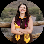
Emily L. Godin
Career Stage: Fourth-year Geosciences Ph.D. candidate.
Why I Care About Science: Science allows me the space, creativity, and freedom to ask and pursue the answers to questions I have about this gorgeous planet we call home.
As a first-generation college student, I never imagined I would become a scientist, but somewhere along the way, I fell in love with understanding how Earth's landscapes formed and how they continue to change.
My geomorphology research focuses on the processes that shape mountain landscapes over millions of years. I am particularly interested in how rivers carve into mountains and what unusual landscape features can tell us about Earth's history. My research in Arizona's Pinaleño Mountains brings together field observations, digital elevation data, and geochemical techniques to investigate why this mountain range has retained its broad, relatively flat summit.
Equally important to me is making geoscience accessible to others. Before pursuing my Ph.D., I earned degrees in geology and secondary Earth science education and worked as a high school Earth science teacher. Today, I develop and study virtual field experiences that allow students to explore real landscapes, investigate geologic processes, and practice thinking like scientists, even when they cannot visit these places themselves.
Ultimately, I hope to become a professor who combines research and teaching. Whether I'm exploring mountain streams, developing virtual field trips, or working with students, my goal is to better understand Earth's landscapes and help others discover just how fascinating they are.
Lab Notes
Nothing posted yet.
Project Backers
- 0Backers
- 100%Funded
- $9,821Total Donations
- $0Average Donation