About This Project
Ampituna is a large, hilltop settlement rumored to be located between the Chancay and Huaura Valleys in Peru. The goal of this study is to find Ampituna and map it using a GPS and balloon imaging. This study is key for understanding how ancient groups moved and interacted between valleys and also will help local peoples gain a better sense of their histories.Ask the Scientists
Join The DiscussionWhat is the context of this research?
Competition over access to resources is a major cause of conflict in the world today. However, resource scarcity is an ancient problem and groups throughout history have employed different strategies to overcome it. Previous research conducted by the Huanangue Valley Archaeology Project has demonstrated that coastal groups were able to peacefully share access to water with local groups in the Huanangue Valley by providing marine products (shellfish, fish, possibly salt, among other goods) to local groups in exchange for rights to water. However, we still know little about the dynamics of this trade. Specifically, how did people (and marine goods) move between the coast and the Huanangue Valley? Ampituna may hold the key to understanding the dynamics of this movement.
What is the significance of this project?
Documenting and mapping Ampituna is critical for a number or reasons:
- Locating and documenting the site is critical to ensuring its preservation as many archaeological sites are lost to mining, farming and other human activities
- Due to its unique inter-valley location, Ampituna may be key to understanding how groups from the Chancay and Huanangue Valleys interacted and may provide insight into regional interaction more generally.
- This projects provides us with the opportunity to further test and develop balloon mapping, a relatively new technique where low-altitude aerial photos are taken by suspending a digital camera on a balloon or kite which is then flown over the site. This allows us to make high quality maps at a low cost. We also plan to train local people in using this technique.
What are the goals of the project?
We have three main goals:
- Test balloon mapping technology at site of Cerro Blanco in order to develop a methodology to use at Ampituna. Cerro Blanco is a good candidate for testing the rig. The site is easily accessed and aerial photographs already exist, making it possible to check the accuracy of our balloon photos
- Finding and mapping Ampituna. We will hire a local guide and, starting from the highland town of Ihauri, hike to the location where local people say Ampituna is. We will then camp at the site and use the methodology we developed at Cerro Blanco to map the site.
- Train local people in the use of the balloon rig. The Huanangue Valley is remote and local people often need mapping services. Teaching them to use the rig will free them from relying on topographers from the capital.
Budget
I will be defending my dissertation this semester (which is super exiting!!) and this project will form the basis of my post-doctoral research. This puts me in a somewhat tricky position as there are not many grants available to those of us who are transitioning from being graduate students to being early career professionals. As such, your support will be vital to the success of this project. If all goes well, the seed data that I gather here will form the foundation for future grants from more traditional sources.
An important part of this project will be working with and training local community members in balloon mapping. Thus your contributions will not only be advancing science, but will also be going towards community development!
Meet the Team
Affiliates
PhD Candidate Status in Anthropology, Vanderbilt University 2009
Team Bio
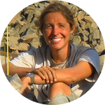
I am a PhD Candidate in archaeology at Vanderbilt University working to finish my dissertation. I fell in love with archaeology when I was in elementary school and my grandmother took me to see an exhibit of Pre Columbian art at the Art Institute in Chicago. I remember listening to her explain the iconography of the Yaya-Mama statues from Bolivia and thinking, I want to be able to do that someday! This passion lead me to a high school internship at the Field Museum in Chicago and from there to the University of Chicago where I completed my BA in Anthropology, and now I am just a few steps away from completing my PhD at Vanderbilt University. I am also an avid runner and have become well known in the community where my research is based as being the crazy running girl as I often ran laps around town after finishing the day's field work!Kasia Szremski
I am a PhD Candidate in archaeology at Vanderbilt University working to finish my dissertation. I fell in love with archaeology when I was in elementary school and my grandmother took me to see an exhibit of Pre Columbian art at the Art Institute in Chicago. I remember listening to her explain the iconography of the Yaya-Mama statues from Bolivia and thinking, I want to be able to do that someday! This passion lead me to a high school internship at the Field Museum in Chicago and from there to the University of Chicago where I completed my BA in Anthropology, and now I am just a few steps away from completing my PhD at Vanderbilt University. I have 10 years of archaeological field experience working in Peru, and am fluent in Spanish.
Additional Information

Huanangue Valley Archaeological Project excavations from 2012,
 Camelid vertebrae from Salitre. Camelids would have been important for moving goods between the Huananague Valley and the coast.
2012 Huanangue Valley Archaeological Project field crew.
Project Backers
- 6Backers
- 27%Funded
- $740Total Donations
- $123.33Average Donation
