Please wait...
About This Project
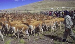
Large-scale communal game drives among humans have never been scientifically documented in action. This study will record and analyze Gran Chaccu--an annual communal game drive in the Peruvian Andes where hundreds of people cooperate to corral thousands of wild vicuña for their wool. An aerial drone will be used to record the size and dynamics of these events. The study will advance our understanding of archaeological game drive complexes and the evolution of cooperation in human societies.


