Austin Hill

Austin Hill

May 28, 2016

Group 6 Copy 67
0
    Please wait...

    About This Project

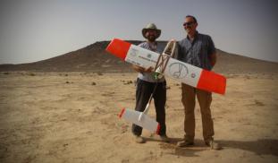
    Unmanned Aerial Vehicles (UAVs, or drones) are revolutionizing archaeological landscape mapping. Using drones, we will conduct a high-resolution aerial survey of previously unknown prehistoric monuments and archaeological sites in the eastern Black Desert of Jordan. Aerial surveys such as this can be particularly useful for recording prehistoric structures that tend to be small and difficult to identify from satellite images.

    Blast off!

    Browse Other Projects on Experiment

    Related Projects

    Using smart feeders to increase lemur activity and stimulate human interest

    Low activity levels in captive animals are common because they don't have to search for food, unlike their...

    Understanding the terminal ballistics of Stone Age hunting projectiles

    Projectile weapons were essential to the daily lives of ancient people. Although studied by archaeologists...

    Feeding the Gods: What Plants Were the Maya Growing in the City Center of La Milpa, Belize?

    We know that at La Milpa, the Maya built agricultural terraces. We don't know what they were growing there...

    Backer Badge Funded